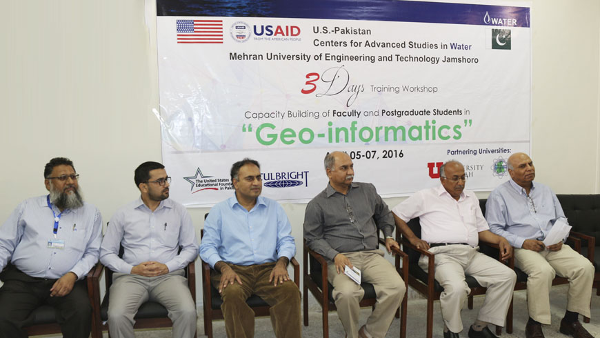
GIS Lab and Three-Day Training Workshop on “Geo-informatics” inaugurated at USPCAS-W, MUET Jamshoro
Dr. Ghous Bux Khaskheli, acting Vice Chancellor Mehran University of Engineering and Technology (MUET) inaugurated Geographic Information System (GIS) Laboratory on the occasion of launching ceremony of Three-Day Training Workshop on “Geo-informatics” organized by U.S.-Pakistan Center for Advanced Studies in Water (USPCAS-W) in collaboration with United States Educational Foundation in Pakistan (USEFP)at MUET Jamshoro.
On this occasion Dr. G.B Khaskheli said that GIS is one of the important research tools for collection of data on various fields. He said that in 1993 he had used similar applications during his research project abroad while travelling in helicopter, whereas today’s technology made it possible to get the desired results while sitting in the GIS lab. He said that through this course of Geo-informatics and GIS Lab the researchers will know the positions and update the data of rivers, wetlands, dams, existing crop patterns and usage of water. Dr. Khaskheli further said that the GIS lab and the training course will benefit faculty, students, researchers and other water planning, management and development professionals. Theworkshop participants came from different universities of Sindh.
On this occasion Dr. Mohammad Aslam Chaudhry, Chief of Party USPCAS-W, University of Utah, United States said that GIS Lab is the first step towards strengthening the research infrastructure of the Center. Several other Labs are being established to cater the training needs of water professionals representing different institutions, as well as to support the research needs of Center’s faculty and students. Emphasizing the importance of this course, he said that remote sensing and GIS applications can make meaningful contributions towards, assessment, monitoring and management of water resources, as well as improving the informed decision making.
Dr. Kamran Ansari, Deputy Director USPCAS-W in his welcome address said that the GIS lab will help in research activities of the center while the workshop will benefit the participants for their respective research fields. Prof. Dr. Altaf Ali Siyal, training focal person informed that 20 participants from different universities of the province were participating in the workshop where as few are nominated from different heads of the departments of the universities. He said that this workshop will not only impart quality education inGIS, Satellites and Remote Sensing to the students but will also help for researchon irrigation system, agricultural development, Indus Delta, Forests and other the natural resources of Pakistan. He further said that in workshop,the participants will be trained specifically for using satellite data for the better management of water and agricultural resources.Dr. Sajjad Ahmed, trainer of the workshop from University of Nevada Las Vegas, USA, USPCAS-W faculty including Prof. Dr. Abdul Latif Qureshi, Prof. Dr. Shafi M. Kori, Mr. GhulamHussainDars, Mr. Waqaus Ahmed, Mr. Mohammad Ali Nizamani, participants of the workshop and students of USPCAS-W were present on this occasion.

